| P number: | P202395 |
|---|---|
| Old photograph number: | A02447 |
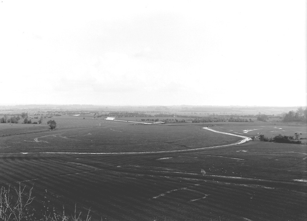
| Caption: | The Adur Valley, from Bramber Castle. Looking ENE. |
| Description: | The Adur Valley, from Bramber Castle. Looking ENE. The Adur Valley between Bramber and Henfield. River Adur meandering through its marshy flood-plain on the Selbornian Beds, Lower Greensand and Weald Clay. In the distance is the Lower Greensand ridge supporting Henfield (on left). |
| Date taken: | Sun Apr 01 00:00:00 GMT 1923 |
| Photographer: | Rhodes, J. |
| Copyright statement: | Crown |
| X longitude/easting: | 518500 |
| Y latitude/northing: | 110500 |
| Coordinate reference system, ESPG code: | 27700 (OSGB 1936 / British National Grid) |
| Orientation: | Landscape |
| Size: | 113.86 KB; 1000 x 721 pixels; 85 x 61 mm (print at 300 DPI); 265 x 191 mm (screen at 96 DPI); |
| Average Rating: | Not yet rated |
| Categories: | Unsorted Images, Geoscience subjects/ Landforms, river/ Flood-plains and alluvial flats |
Loading...
Loading...
Reviews
There is currently no feedback