| P number: | P202720 |
|---|---|
| Old photograph number: | A02772 |
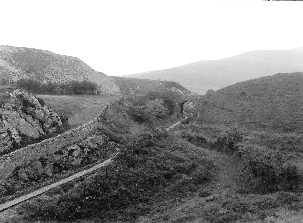
| Caption: | About 3/4 m. E. of Kirkland and 1 1/2 m. ESE of Rowrah Station, Lamplugh. Looking NE. |
| Description: | About 3/4 m. E. of Kirkland and 1 1/2 m. ESE of Rowrah Station, Lamplugh. Looking NE. Dry channel of a subglacial stream of the Lake District ice-cap. See 'Summary of Progress for 1921', App. I, p.125. Looking upstream from the same position as that from which A2770 was taken. Here the channel crosses the watershed between Ennerdale (behind the camera) and Leaps Beck, the valley in the distance. At the bridge the railway follows the channel, which here clearly notches the watershed. The light-shaded slope beyond is the side of a cutting in the far bank of the channel. The distant high ground is Murton Fell, on the other side of Leaps Beck. |
| Date taken: | Tue Jul 01 00:00:00 BST 1924 |
| Photographer: | Rhodes, J. |
| Copyright statement: | Crown |
| X longitude/easting: | 308556 |
| Y latitude/northing: | 518035 |
| Coordinate reference system, ESPG code: | 27700 (OSGB 1936 / British National Grid) |
| Orientation: | Landscape |
| Size: | 222.02 KB; 1001 x 738 pixels; 85 x 62 mm (print at 300 DPI); 265 x 195 mm (screen at 96 DPI); |
| Average Rating: | Not yet rated |
| Categories: | Unsorted Images |
Loading...
Loading...
Reviews
There is currently no feedback