| P number: | P203157 |
|---|---|
| Old photograph number: | A03209 |
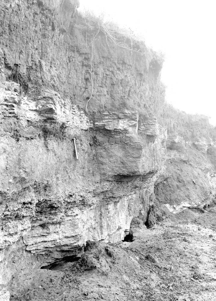
| Caption: | Lamb and Flag Pit, 2 m. W. of Kingston Bagpuize. Looking NW. |
| Description: | Lamb and Flag Pit, 2 m. W. of Kingston Bagpuize. Looking NW. Section of Upper Corallian Beds. A well-known locality described by Messrs. Blake and Hudleston H.B. Woodward, etc. The bed of clay at the top is of Pleistocene age. |
| Date taken: | Tue Sep 01 00:00:00 BST 1925 |
| Photographer: | Rhodes, J. |
| Copyright statement: | Crown |
| X longitude/easting: | 436500 |
| Y latitude/northing: | 198500 |
| Coordinate reference system, ESPG code: | 27700 (OSGB 1936 / British National Grid) |
| Orientation: | Portrait |
| Size: | 324.29 KB; 718 x 1000 pixels; 61 x 85 mm (print at 300 DPI); 190 x 265 mm (screen at 96 DPI); |
| Average Rating: | Not yet rated |
| Categories: | Unsorted Images, Geoscience subjects/ Economic geology/ Building stones, limestone |
Loading...
Loading...
Reviews
There is currently no feedback