| P number: | P000517 |
|---|---|
| Old photograph number: | C03004 |
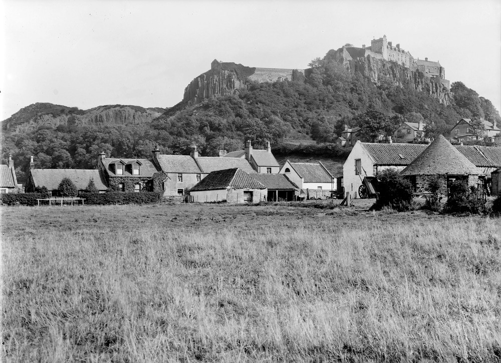
| Caption: | Castle Rock, Stirling. Looking south-east from Raploch. Stirlingshire. Crags of columnar quartz-dolerite of the Stirling sill dipping eastwards. The 'wind-gap', or pass, of Ballengeich is seen slightly to left of centre. |
| Description: | Castle Rock, Stirling. Looking south-east from Raploch. Stirlingshire. Crags of columnar quartz-dolerite of the Stirling sill dipping eastwards. The 'wind-gap', or pass, of Ballengeich is seen slightly to left of centre. The Stirling sill is known from borehole evidence to be about 300 ft. thick and is intruded into various horizons ranging from the top of the Calciferous Sandstone Measures to about the middle of the Limestone Coal Group (both Carboniferous). The wooded scree at the foot of the escarpment conceals an outcrop of these underlying Carboniferous sediments. The outcrop is exposed behind the houses on the left. The outcrop here is one of several striking westward-facing crags which extend south from Abbey Craig and Stirling Castle along the western limb of the Clackmannan Syncline, a major structural feature of the area. |
| Date taken: | Fri Jan 01 00:00:00 GMT 1926 |
| Photographer: | Manson, W. |
| Copyright statement: | Crown |
| Acknowledgment: | This image was digitized with grant-in-aid from SCRAN the Scottish Cultural Resources Access Network |
| X longitude/easting: | 279500 |
| Y latitude/northing: | 693500 |
| Coordinate reference system, ESPG code: | 27700 (OSGB 1936 / British National Grid) |
| Orientation: | Landscape |
| Size: | 277.41 KB; 1000 x 726 pixels; 85 x 61 mm (print at 300 DPI); 265 x 192 mm (screen at 96 DPI); |
| Average Rating: | Not yet rated |
| Categories: | Best of BGS Images/ Images from the archives, Geoscience subjects/ General views/ Igneous rock country |
Loading...
Loading...
Reviews
There is currently no feedback