| P number: | P000728 |
|---|---|
| Old photograph number: | D02067 |
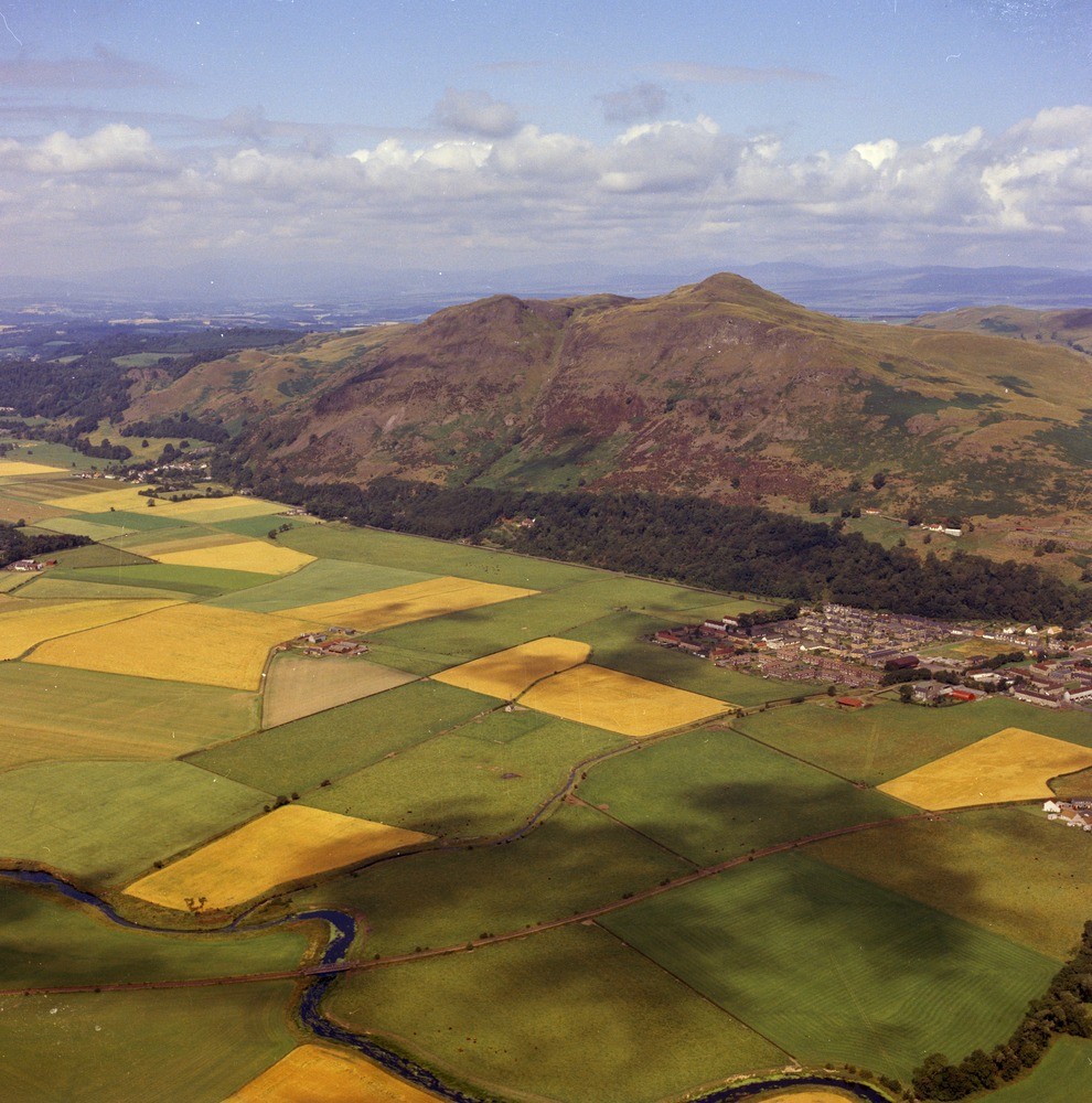
| Caption: | Oblique aerial view of Dumyat, western Ochil Hills, taken from the air north-west of Tullibody. Stirlingshire. The view shows the sharp Ochil fault-scarp. Menstrie can be seen on the right of the photograph. |
| Description: | Oblique aerial view of Dumyat, western Ochil Hills, taken from the air north-west of Tullibody. Stirlingshire. The view shows the sharp Ochil fault-scarp. Menstrie can be seen on the right of the photograph. The high ground with the prominent hill of Dumyat is situated on lavas and agglomerates of Lower Devonian age. The Ochil Fault runs along the foot of the scarp, the low ground being underlain by downthrown Carboniferous rocks which are concealed by the drift-fill of the deep buried channel of the River Devon. Dalradian rocks beyond the Highland Boundary Fault in the far distance. |
| Date taken: | Thu Jan 01 00:00:00 GMT 1976 |
| Photographer: | Christie, A. |
| Copyright statement: | NERC |
| Acknowledgment: | This image was digitized with grant-in-aid from SCRAN the Scottish Cultural Resources Access Network |
| X longitude/easting: | 280500 |
| Y latitude/northing: | 690500 |
| Coordinate reference system, ESPG code: | 27700 (OSGB 1936 / British National Grid) |
| Orientation: | Portrait |
| Size: | 275.57 KB; 990 x 1000 pixels; 84 x 85 mm (print at 300 DPI); 262 x 265 mm (screen at 96 DPI); |
| Average Rating: | Not yet rated |
| Categories: | Unsorted Images, Geoscience subjects/ Structural features/ Fault breccia, Geoscience subjects/ Landforms, river/ Escarpments |
Loading...
Loading...
Reviews
There is currently no feedback