| P number: | P211735 |
|---|---|
| Old photograph number: | A12198 |
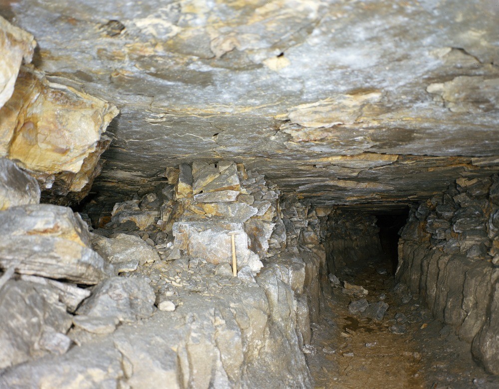
| Caption: | Crawstone Ironstone Mine, Ironbridge, Shropshire. |
| Description: | Looking north at the abandoned Crawstone Ironstone Mine, Ironbridge. The main road in the mine is about 1.7 m. high. The base of the roadway was sunk lower than the ironstone level (about hammer level) - a process known as 'bating' or 'dinting' - to provide sandstone blocks (pack) to fill the empty space (gob or goaf) remaining after the mineral had been mined. The pack appears behind the hammer. This method of mining is known as advancing longwall. From the main roadway stall roads or gates (left) go out to the working face (stall), all of which are connected on a fan-like advancing wall. The mine was abandoned in the early 19th century. The Crawstone Ironstone at the base of the Carboniferous Coal Measures sequence was worked. The ironstone is a bed of ferruginous sandstone underlain by a thin coal seam and overlain by a bed of sandstone containing fossils of the giant clubmoss Sigillaria. |
| Date taken: | Tue Jan 01 00:00:00 GMT 1974 |
| Photographer: | Evans, H.J. |
| Copyright statement: | NERC |
| X longitude/easting: | 367100 |
| Y latitude/northing: | 303700 |
| Coordinate reference system, ESPG code: | 27700 (OSGB 1936 / British National Grid) |
| Orientation: | Landscape |
| Size: | 248.04 KB; 1000 x 781 pixels; 85 x 66 mm (print at 300 DPI); 265 x 207 mm (screen at 96 DPI); |
| Average Rating: | Not yet rated |
| Categories: | Unsorted Images, Geoscience subjects/ Economic geology/ Metalliferous mining, ironstone, opencast |
Loading...
Loading...
Reviews
There is currently no feedback