| P number: | P000939 |
|---|---|
| Old photograph number: | D02727 |
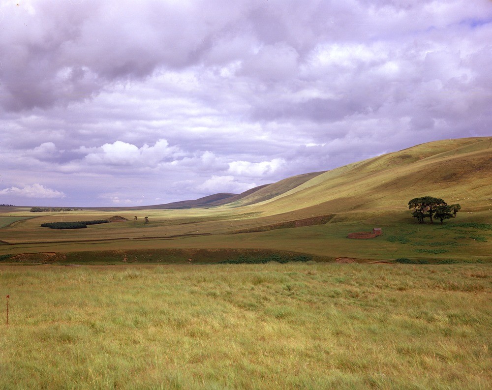
| Caption: | Looking north-east from Gladhouse Cottage, south-west of Gladhouse Reservoir. Lothian Region. |
| Description: | The gently sloping ground at the foot of the scarp is underlain by Calciferous Sandstone Measures (Lower Carboniferous). The high ground to the right on the south-east side of the fault, is formed mainly by folded indurated greywackes and shales of Ordovician age. Scarp feature of the Lammermuir Fault. The fault, trending north-east, with downthrow to the north-west is thought to pass along the foot of the prominent feature on the right. |
| Date taken: | Mon Jan 01 00:00:00 GMT 1979 |
| Photographer: | McTaggart, F.I. |
| Copyright statement: | NERC |
| Acknowledgment: | This image was digitized with grant-in-aid from SCRAN the Scottish Cultural Resources Access Network |
| X longitude/easting: | 328800 |
| Y latitude/northing: | 651100 |
| Coordinate reference system, ESPG code: | 27700 (OSGB 1936 / British National Grid) |
| Orientation: | Landscape |
| Size: | 212.31 KB; 1000 x 793 pixels; 85 x 67 mm (print at 300 DPI); 265 x 210 mm (screen at 96 DPI); |
| Average Rating: | Not yet rated |
| Categories: | Unsorted Images, Geoscience subjects/ Landforms, river/ Escarpments |
Loading...
Loading...
Reviews
There is currently no feedback