| P number: | P001076 |
|---|---|
| Old photograph number: | D03511 |
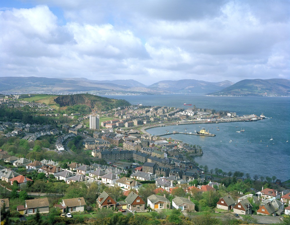
| Caption: | Gourock and the Firth of Clyde. Strathclyde Region. View over Gourock to Holy Loch. Craigmuschat Quarry (disused) in left of centre. |
| Description: | Gourock and the Firth of Clyde. Strathclyde Region. View over Gourock to Holy Loch. Craigmuschat Quarry (disused) in left of centre. The Firth of Clyde (and Loch Long opposite and Gare Loch) is a drowned ice-scoured valley. The area would have changed little since the last glaciers disappeared, about 10,000 years ago. Crushed rock aggregate was extracted from the Craigmuschat Quarry from an irregular sill-like body of feldsparpyhric trachyte. It has subsequently been used for waste disposal. |
| Date taken: | Fri Jan 01 00:00:00 GMT 1982 |
| Photographer: | Bain, T.S. |
| Copyright statement: | NERC |
| Acknowledgment: | This image was digitized with grant-in-aid from SCRAN the Scottish Cultural Resources Access Network |
| X longitude/easting: | 224000 |
| Y latitude/northing: | 677000 |
| Coordinate reference system, ESPG code: | 27700 (OSGB 1936 / British National Grid) |
| Orientation: | Landscape |
| Size: | 273.81 KB; 1000 x 777 pixels; 85 x 66 mm (print at 300 DPI); 265 x 206 mm (screen at 96 DPI); |
| Average Rating: | Not yet rated |
| Categories: | Best of BGS Images/ Landscapes |
Loading...
Loading...
Reviews
There is currently no feedback