| P number: | P001448 |
|---|---|
| Old photograph number: | C00595 |
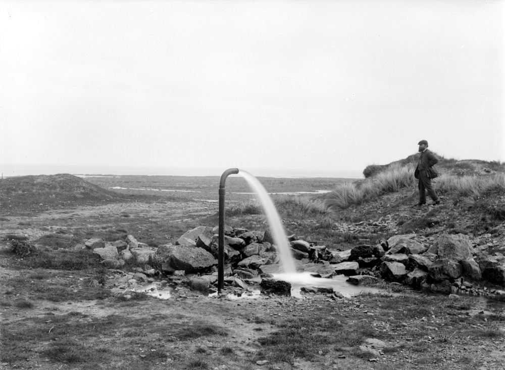
| Caption: | Old Catcraig Quarry 3.6 km. east of Dunbar, East Lothian. Water spouting from a bore-hole. The bore starts from the bottom part of the Longcraig Upper Limestone. |
| Description: | Old Catcraig Quarry 3.6 km. east of Dunbar, East Lothian. Water spouting from a bore-hole. The bore starts from the bottom part of the Longcraig Upper Limestone. The Catcraig borehole was drilled to 131 m. depth in 1905 for a coal exploration project. It proved to be barren of coal, but encountered artesian groundwater from the top of a thick sandstone unit at 22 m. below ground level. The water, which formed a 3 m. high spout after drilling was completed, was measured at between 4 and 10 litres/second flow. Considered as a supply source for Dunbar in 1907, the water was eventually piped to East Barns Farm. The flow stops during periods of drought. |
| Date taken: | Fri Jan 01 00:00:00 GMT 1904 |
| Photographer: | Lunn, R. |
| Copyright statement: | Crown |
| Acknowledgment: | This image was digitized with grant-in-aid from SCRAN the Scottish Cultural Resources Access Network |
| X longitude/easting: | 371500 |
| Y latitude/northing: | 677500 |
| Coordinate reference system, ESPG code: | 27700 (OSGB 1936 / British National Grid) |
| Orientation: | Landscape |
| Size: | 179.78 KB; 1000 x 732 pixels; 85 x 62 mm (print at 300 DPI); 265 x 194 mm (screen at 96 DPI); |
| Average Rating: | Not yet rated |
| Categories: | Best of BGS Images/ Images from the archives |
Loading...
Loading...
Reviews
There is currently no feedback