| P number: | P222157 |
|---|---|
| Old photograph number: | L01036 |
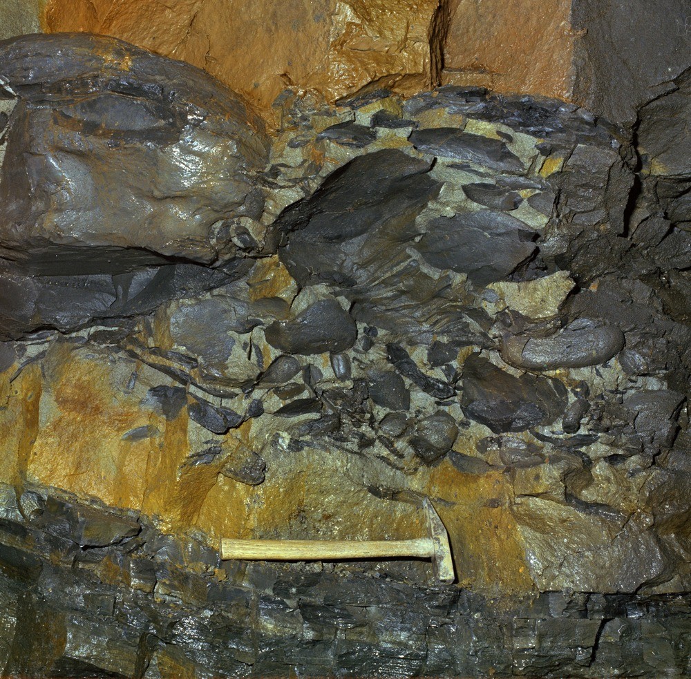
| Caption: | Blackburn Corporation main outfall sewer tunnel, 3580 ft. (1091 m.) from Troutbrook Shaft. Looking N., side of tunnel. |
| Description: | Blackburn Corporation main outfall sewer tunnel, 3580 ft. (1091 m.) from Troutbrook Shaft. Looking N., side of tunnel. Lag conglomerate of silty mudstone in sandstone. Base of second leaf of Alum Crag Grit (Namurian, R2a). |
| Date taken: | Tue Oct 01 00:00:00 BST 1974 |
| Photographer: | Thornton, K.E. |
| Copyright statement: | NERC |
| X longitude/easting: | 363380 |
| Y latitude/northing: | 427870 |
| Coordinate reference system, ESPG code: | 27700 (OSGB 1936 / British National Grid) |
| Orientation: | Landscape |
| Size: | 425.36 KB; 1000 x 983 pixels; 85 x 83 mm (print at 300 DPI); 265 x 260 mm (screen at 96 DPI); |
| Average Rating: | Not yet rated |
| Categories: | Unsorted Images, Geoscience subjects/ Rocks, sedimentary/ Conglomerates and breccias |
Loading...
Loading...
Reviews
There is currently no feedback