| P number: | P222535 |
|---|---|
| Old photograph number: | L01732 |
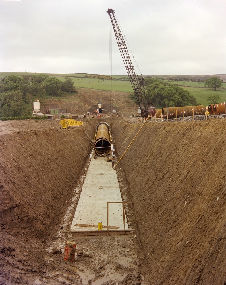
| Caption: | River Derwent Valley near Eddy's Bridge near Edmundbyers, Northumberland. |
| Description: | River Derwent Valley near Eddy's Bridge near Edmundbyers. Kielder Water Scheme - 'cut and cover' pipeline section across Derwent Valley. Close-up of construction of pipeline section of Tyne-Tees Aqueduct linking Greymare Hill-Airy Holm-Derwent Tunnel and Derwent-Wear Tunnel. The pipeline is largely cut into sandy and silty terrace deposits with comparatively low stone content. The trench overlies the approximate centre line of the buried valley of the Derwent, here thought to be about 48 m. (150 ft.) deep. In the background the north portal of the Derwent-Wear Tunnel cut into massive sandstone ('First Grit') of high Namurian age (Carboniferous) and on the south bank of the present River Derwent. The Kielder Water Scheme was designed to bring water supplies from Keilder Water, the largest man-made lake in Europe in the River Tyne catchment area southwards to the River Wear and Tees. |
| Date taken: | Thu Jun 16 00:00:00 BST 1977 |
| Photographer: | Thornton, K.E. |
| Copyright statement: | NERC |
| X longitude/easting: | 404130 |
| Y latitude/northing: | 551000 |
| Coordinate reference system, ESPG code: | 27700 (OSGB 1936 / British National Grid) |
| Orientation: | Portrait |
| Size: | 261.15 KB; 795 x 1000 pixels; 67 x 85 mm (print at 300 DPI); 210 x 265 mm (screen at 96 DPI); |
| Average Rating: | Not yet rated |
| Categories: | Best of BGS Images/ Industrial geology |
Loading...
Loading...
Reviews
There is currently no feedback