| P number: | P002866 |
|---|---|
| Old photograph number: | D03444 |
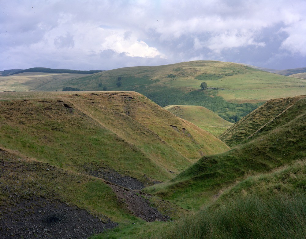
| Caption: | Glen Quey, looking east, 6 km. north-east of Dollar, Tayside Region. |
| Description: | Glen Quey, looking east, 6 km. north-east of Dollar, Tayside Region. Conspicuous ice-marginal gravel fan/delta, composed of material with a south-westerly derivation, built up by waters draining eastwards through Glen Quey. The fan is now deeply dissected by postglacial drainage. As the ice began to retreat at the end of the last major glaciation, the valley of the Forth Estuary, and tributaries like Glen Devon, were still full of stagnant masses of ice which blocked natural drainage routes. Waters flowing eastwards via the Dollar - Glen Quey gap built up terraces and a large gravel fan/delta into the flooded Glen Devon. When the impounded waters were eventually released, the gravel fan became dissected by normal terrestrial drainage. |
| Date taken: | Fri Jan 01 00:00:00 GMT 1982 |
| Photographer: | Christie, A. |
| Copyright statement: | NERC |
| Acknowledgment: | This image was digitized with grant-in-aid from SCRAN the Scottish Cultural Resources Access Network |
| X longitude/easting: | 298800 |
| Y latitude/northing: | 703500 |
| Coordinate reference system, ESPG code: | 27700 (OSGB 1936 / British National Grid) |
| Orientation: | Landscape |
| Size: | 250.83 KB; 1000 x 783 pixels; 85 x 66 mm (print at 300 DPI); 265 x 207 mm (screen at 96 DPI); |
| Average Rating: | Not yet rated |
| Categories: | Unsorted Images, Geoscience subjects/ Landforms, erosion |
Loading...
Loading...
Reviews
There is currently no feedback