| P number: | P002920 |
|---|---|
| Old photograph number: | D05300 |
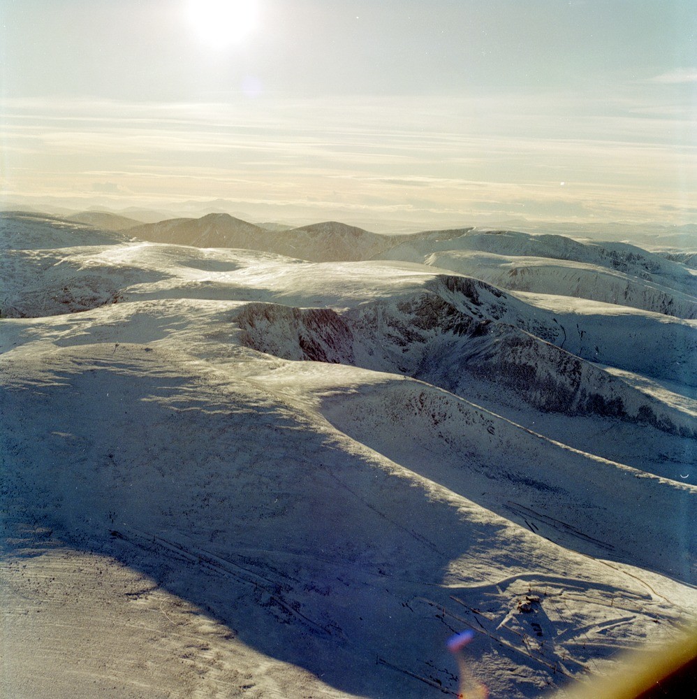
| Caption: | Oblique aerial view of north face of Cairngorms and plateau, Aberdeenshire. A view south-westwards over the northern edge of the Cairngorm plateau and the north-facing corries. |
| Description: | Oblique aerial view of north face of Cairngorms and plateau, Aberdeenshire. A view south-westwards over the northern edge of the Cairngorm plateau and the north-facing corries. The Cairngorm summit weather station is clearly visible in the left middle distance with the top of the ski lift close to the bottom right hand corner. The northern edge of the granite plateau, here between 1100 and 1200 m. O.D. is etched by a series of fine corries; Coire Cas, Coire an Sneachda and Coire an Lochain separated by particularly elongate spurs. Separated by the deep cut of the Larig Ghru, Cairn Toul (left) and Braeriach (right) dominate the skyline. |
| Photographer: | Unknown |
| Copyright statement: | NERC |
| Acknowledgment: | This image was digitized with grant-in-aid from SCRAN the Scottish Cultural Resources Access Network |
| X longitude/easting: | 300000 |
| Y latitude/northing: | 804000 |
| Coordinate reference system, ESPG code: | 27700 (OSGB 1936 / British National Grid) |
| Orientation: | Portrait |
| Size: | 290.39 KB; 998 x 1000 pixels; 84 x 85 mm (print at 300 DPI); 264 x 265 mm (screen at 96 DPI); |
| Average Rating: | Not yet rated |
| Categories: | Best of BGS Images/ Landscapes |
Loading...
Loading...
Reviews
There is currently no feedback