| P number: | P002933 |
|---|---|
| Old photograph number: | MNS01402 |
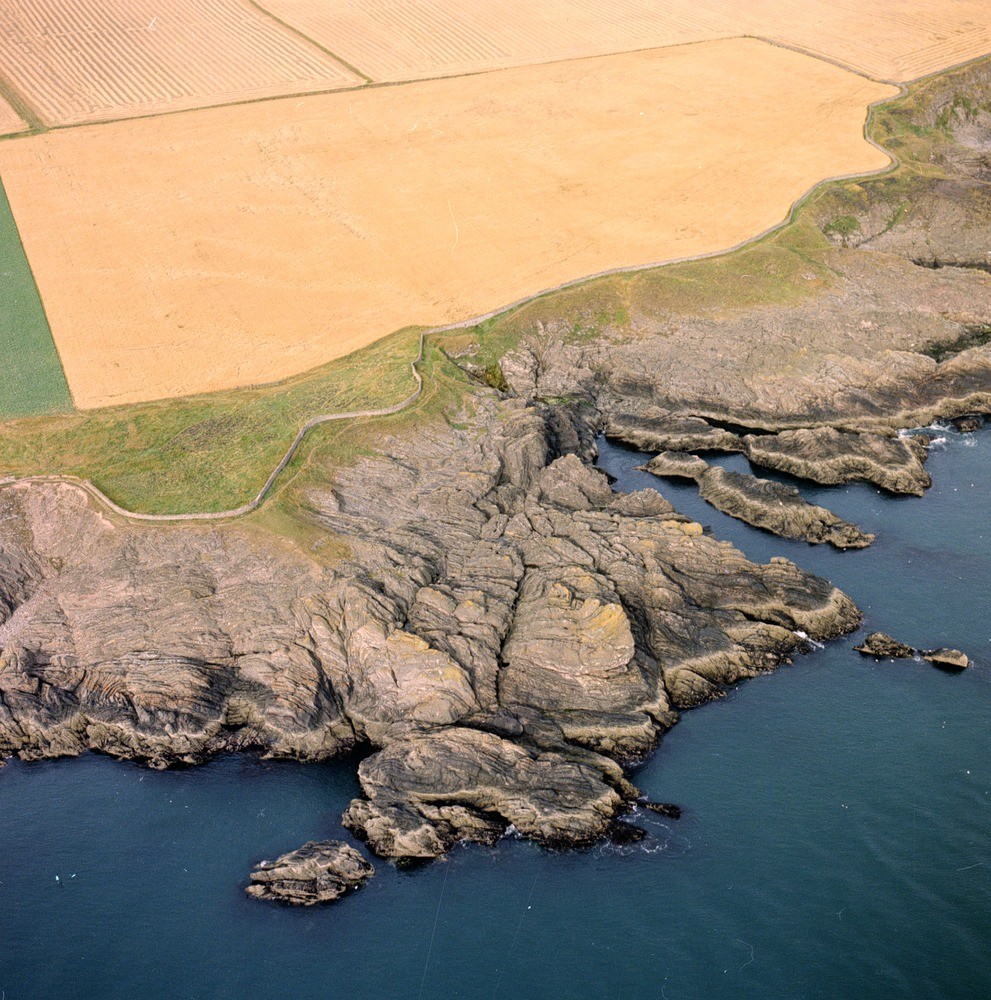
| Caption: | Oblique aerial view from the east-south-east taken at Whalt Point - Willie Anderson, Eyemouth shore, Berwickshire. |
| Description: | The rocks, typical turbidites, are an alternating series of greywackes and siltstones in beds seldom exceeding 0.5 m. in thickness. They are predominantly grey in colour. The folds in the rocks north of Whalt Point are markedly more complex than the folds south of the point. The folding occurred during the Caledonian Orogeny towards the end of the Silurian, the geosyncline, a large sedimentary basin was compressed from the north-north-west and south-south-east, folded, faulted, and elevated to form a chain of mountains which have subsequently been eroded. A typical coastal view showing faulted Silurian greywackes, the faults are picked out by erosion, the strike of beds is north-east - south-west. |
| Date taken: | Sat Jan 01 00:00:00 GMT 1972 |
| Photographer: | Unknown |
| Copyright statement: | Unknown |
| Acknowledgment: | This image was digitized with grant-in-aid from SCRAN the Scottish Cultural Resources Access Network |
| X longitude/easting: | 395500 |
| Y latitude/northing: | 663900 |
| Coordinate reference system, ESPG code: | 27700 (OSGB 1936 / British National Grid) |
| Orientation: | Portrait |
| Size: | 352.41 KB; 991 x 1000 pixels; 84 x 85 mm (print at 300 DPI); 262 x 265 mm (screen at 96 DPI); |
| Average Rating: | Not yet rated |
| Categories: | Best of BGS Images/ Geological structures |
Loading...
Loading...
Reviews
There is currently no feedback