| P number: | P005454 |
|---|---|
| Old photograph number: | L00411 |
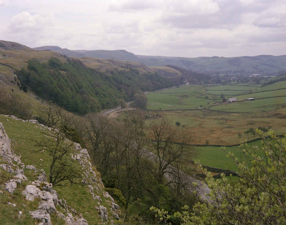
| Caption: | Giggleswick Scar. |
| Description: | Giggleswick Scar. The road follows the line of the South Craven Fault separating gently-dipping Great Scar Limestone in the wooded bluff from the folded and downthrown Millstone Grit of the Craven Basin, which forms the farm land to the right. |
| Date taken: | Tue May 01 00:00:00 BST 1973 |
| Photographer: | Thornton, K.E. |
| Copyright statement: | NERC |
| Acknowledgment: | This image was digitized with grant-in-aid from JIDI the JISC Image Digitization Initiative |
| X longitude/easting: | 378900 |
| Y latitude/northing: | 466400 |
| Coordinate reference system, ESPG code: | 27700 (OSGB 1936 / British National Grid) |
| Orientation: | Landscape |
| Size: | 241.29 KB; 1000 x 788 pixels; 85 x 67 mm (print at 300 DPI); 265 x 208 mm (screen at 96 DPI); |
| Average Rating: | Not yet rated |
| Categories: | Unsorted Images, Geoscience subjects/ Named locality, Geoscience subjects/ Structural features/ Fault breccia |
Loading...
Loading...
Reviews
There is currently no feedback