| P number: | P005781 |
|---|---|
| Old photograph number: | A11418 |
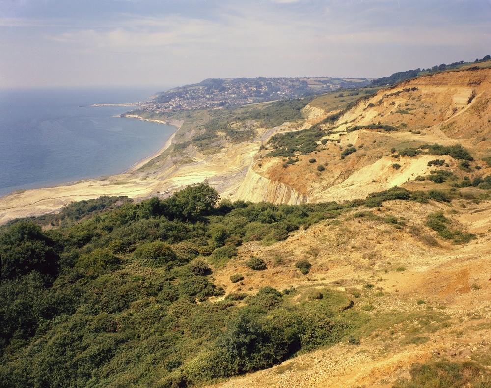
| Caption: | Charmouth, Dorset. Looking SW. |
| Description: | Charmouth, Dorset. Looking SW. Black Ven landslide. Partially overgrown undercliff with flow track and lobe of mudflow. Undercliff terrace with debris from Foxmould and Chert Beds (Upper Greensand) cliffs above. Town of Lyme Regis in the distance. (Forms a panorama with A11417 and A11419.) |
| Date taken: | Fri Jan 01 00:00:00 GMT 1971 |
| Photographer: | Pulsford, J.M. |
| Copyright statement: | NERC |
| Acknowledgment: | This image was digitized with grant-in-aid from JIDI the JISC Image Digitization Initiative |
| X longitude/easting: | 336500 |
| Y latitude/northing: | 93500 |
| Coordinate reference system, ESPG code: | 27700 (OSGB 1936 / British National Grid) |
| Orientation: | Landscape |
| Size: | 347.11 KB; 1000 x 791 pixels; 85 x 67 mm (print at 300 DPI); 265 x 209 mm (screen at 96 DPI); |
| Average Rating: | Not yet rated |
| Categories: | Best of BGS Images/ Landscapes, Geoscience subjects/ Named locality, Geoscience subjects/ Landforms, weathering/ Landslips |
Loading...
Loading...
Reviews
There is currently no feedback