| P number: | P205964 |
|---|---|
| Old photograph number: | A06035 |
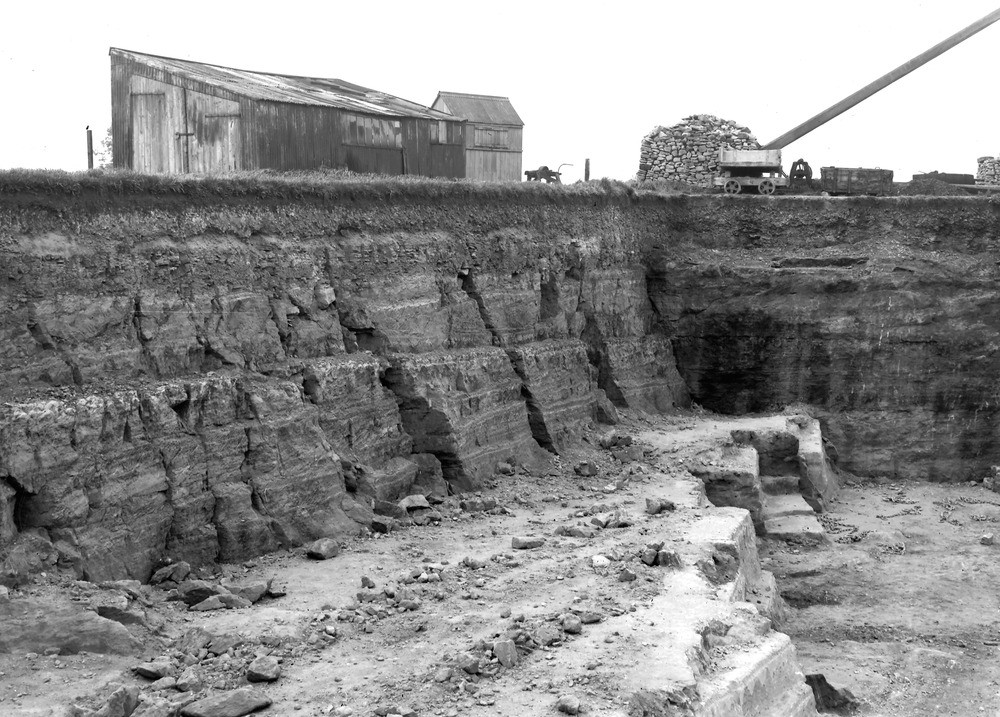
| Caption: | Doulting Quarries, 2 m. E. of Shepton Mallet. Looking W. |
| Description: | Doulting Quarries, 2 m. E. of Shepton Mallet. Looking W. Quarries in Doulting Freestone, Cheylinch, Doulting. Doulting Freestone is a local development, south of the Mendip Hills, of the upper beds of the Inferior Oolite (truellei hemera). The stone, for centuries, has been used for carving. The amount of overburden (Anabacia Limestones and Rubbly Beds, of Schloenbachi hemera) necessary to be removed before reaching the freestone is well shown. The Doulting Freestone forms the ledge of whitish rock at the base of the quarry. |
| Date taken: | Mon Aug 01 00:00:00 BST 1932 |
| Photographer: | Rhodes, J. |
| Copyright statement: | Crown |
| X longitude/easting: | 364500 |
| Y latitude/northing: | 143500 |
| Coordinate reference system, ESPG code: | 27700 (OSGB 1936 / British National Grid) |
| Orientation: | Landscape |
| Size: | 275.32 KB; 1000 x 717 pixels; 85 x 61 mm (print at 300 DPI); 265 x 190 mm (screen at 96 DPI); |
| Average Rating: | Not yet rated |
| Categories: | Unsorted Images, Geoscience subjects/ Economic geology/ Building stones, limestone |
Loading...
Loading...
Reviews
There is currently no feedback