| P number: | P207462 |
|---|---|
| Old photograph number: | A07537 |
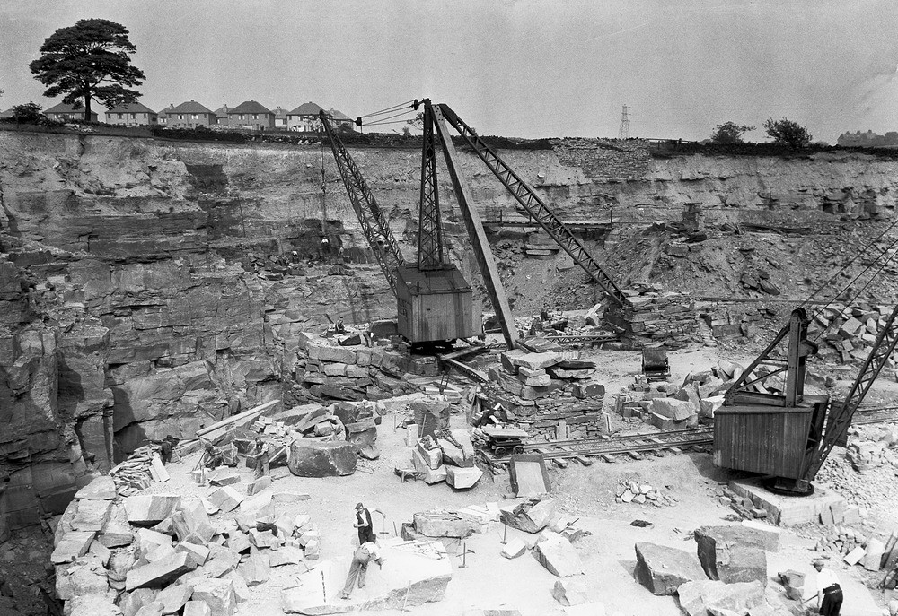
| Caption: | Waterhouse and Denbigh's Quarry, 1600 yd. south-east of Shipley Station. Looking east, Shipley, Yorkshire. |
| Description: | Large quarry in Gaisby Rock a sandstone between the Carboniferous Hard Bed Coal and the Elland Flags. This sandstone is locally very thick and is worked for building stone. The extensive working face of the quarry, extending close to the housing estate above, is an indication of its former importance as a local building stone producer. The fine grained sandstone was worked both for block and paving stone. This sandstone is one of many worked in the Lower Coal measures of the West Yorkshire area for local building stone. Most of the stone produced was used for housing, factories and mills in Shipley and the surrounding area. |
| Date taken: | Wed Jun 01 00:00:00 BST 1938 |
| Photographer: | Rhodes, J. |
| Copyright statement: | Crown |
| X longitude/easting: | 416500 |
| Y latitude/northing: | 435500 |
| Coordinate reference system, ESPG code: | 27700 (OSGB 1936 / British National Grid) |
| Orientation: | Landscape |
| Size: | 339.14 KB; 1000 x 687 pixels; 85 x 58 mm (print at 300 DPI); 265 x 182 mm (screen at 96 DPI); |
| Average Rating: | Not yet rated |
| Categories: | Unsorted Images, Geoscience subjects/ Economic geology/ Quarries |
Loading...
Loading...
Reviews
There is currently no feedback